Harold Fisk’s 1944 Mississippi map layers earlier river courses into one image, suggesting a creative way to make change visible.
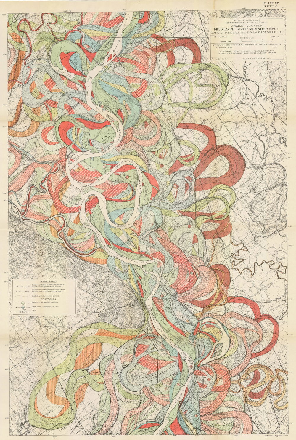
A pale channel winds down the page, surrounded by so many colored loops that the river seems to occupy several routes at once. That impression is close to the map’s central idea. One stretch of landscape carries evidence of many earlier configurations.
A geological investigation in color
Harold N. Fisk prepared his 1944 investigation of the lower Mississippi’s alluvial valley for the Mississippi River Commission. The accompanying maps include this sixth sheet of a fifteen-sheet series showing ancient courses within the river’s meander belt. The original sheet is preserved in a digital copy hosted by Louisiana State University. Its title block and symbols remain available to inspect.
The New York Public Library describes the larger project as part of a study concerned with navigation and safety. Its explanation distinguishes prehistoric paths from historical courses associated with 1765, 1820, and 1880. The colors carry information about change over time. They should be read with the map’s key, rather than treated as a simple decorative palette.
Let the layers stay visible
On this sheet, the pale channel provides a strong route through the crowded field. Around it, red bands, green curves, blue passages, and yellow areas overlap and diverge. Some loops nearly close; others disappear beneath later forms or continue beyond the sheet’s edge.
The contrast in mark-making is especially useful. Large colored areas establish the broad patterns, while fine black lines preserve a second level of geographical detail. You can step back to see the sweep of the bends, then move closer to inspect a smaller junction. The map supports both kinds of looking.
Its straight frame contains forms that continually resist straightness. Even the title block and small legend become quiet rectangular pauses among the curves. Those stable areas help the dense image remain approachable.
Our creative reading is that an earlier version does not always need to disappear when a new version arrives. Keeping traces of change can reveal relationships that a final, cleaned-up image would hide. In a scientific map those traces require evidence and careful interpretation. In a personal art exercise, they can also become a way to describe how an idea developed.
Try it: keep the earlier route visible
Sketch an imaginary park with a gate, pond, and bench. Draw three routes in different colors: the direct way, a pause at the pond, and a winding detour. Keep every route visible and add a key, using a dashed line for one path too. Where do the alternatives meet? That junction is the start of your caption.
Artwork & sources
Ancient Courses: Mississippi River Meander Belt, Plate 22, Sheet 6
Harold N. Fisk / Mississippi River Commission · 1944 · Printed geological map
U.S. Army Corps of Engineers / Mississippi River Commission. Digital image via Public Domain Image Archive.
View the collection record. Image: Public domain U.S. government work; no additional digital rights claimed.
- Original Plate 22, Sheet 6, preserved by Louisiana State University
- New York Public Library: Fisk’s 1944 geological investigation
- Public Domain Image Archive: image provenance and reuse status
Historical details are drawn from the linked collections. The visual reading and creative exercise are original Storied Spark contributions. Storied Spark is independent of these institutions.
Comments
Post a Comment